Lake Tahoe is the jewel of the Sierra and there is no better way to experience its beauty than on one of the many hiking trails the basin has to offer. The area’s trails have something to offer for all ability levels, from adventurer seekers looking to go deep into the wilderness, to a casual family trek with young children. No matter what you are looking for during your stay at a Lake Tahoe vacation rental, the views and memories can't be beat!
Here are a few of our staff’s favorite Tahoe Hiking Trails
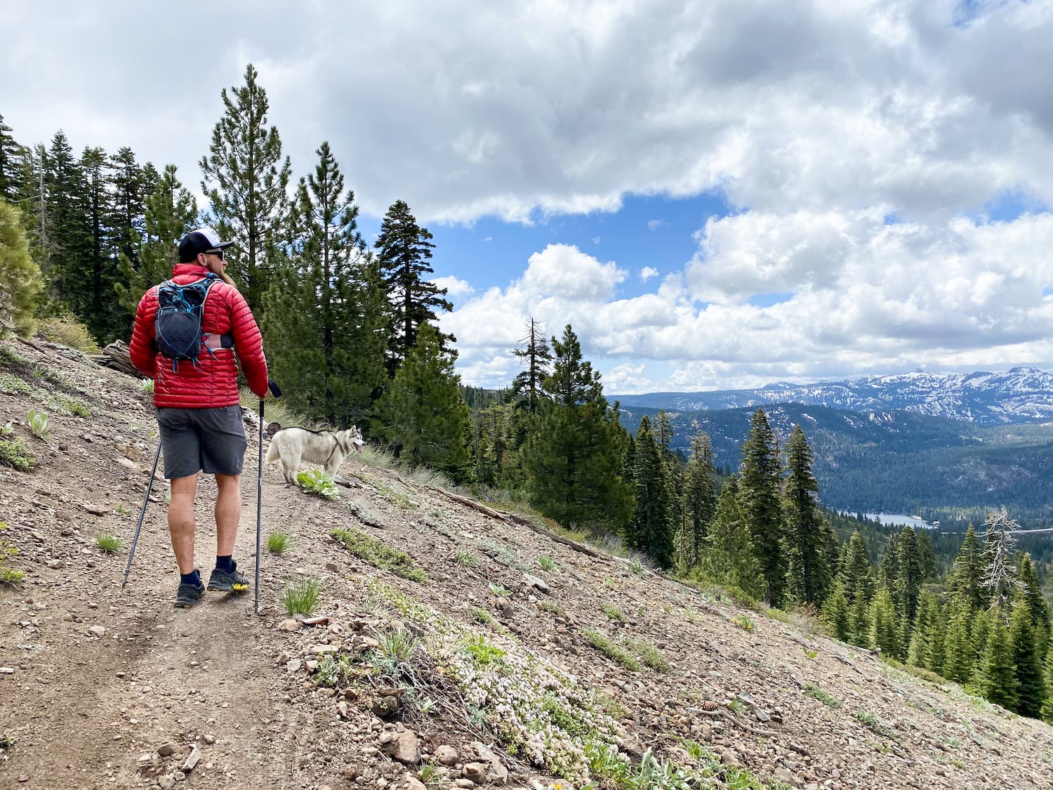
Brockway Summit to Watson Lake
Distance: 13.4 miles round trip Elevation Change: 7000 ft. to 7760 ft. Hiking Watson Lake Trail: Casual hikers love Watson Lake for its beauty and seclusion.
Eagle Rock Hiking Trail (Easy)
Eagle Rock is an eroded, dormant volcano. This hike leads up and across the enormous volcanic rock formation. From the top are panoramic overlooks of Lake Tahoe. The trail is accessed via Blackwood Canyon on Highway 89. It's an easy, less than a mile, walk up to the top of Eagle Rock.
Emigrant Trail
Technical Level: Beginner Mountain Bikers and Hikers Elevation Gain: Around 1,700′ The Ride: 15 miles one way (trail loops back) Location: Truckee, CA Season: Late Spring/Summer This is Truckee’s most popular mountain biking trail.
Marlette Lake
Difficulty: Moderate Elevation: 7000′ / 8000′ Mileage (one way): 5 miles Directions to Trailhead: Park at the Spooner Lake Trailhead, located in Lake Tahoe Nevada State Park, just northwest of Highway 50 / 28 junction.
Meeks Bay Trailhead
Difficulty: Moderate Elevation: 6240′ / 8880′ Mileage (one way): 4.5 to 8 miles Trail: This moderate hike takes you along the northernmost part of the Tahoe-Yosemite Trail.
Mt. Rose Trail
Difficulty: Difficult Elevation: 8700′ / 10778′ Mileage (one way): 6 miles Directions to Trailhead: Take Highway 431 (Mt. Rose Highway) north of Incline Village. Park at the trailhead located one mile south of the summit.
Paige Meadow
Difficulty: Easy Elevation: Flat Mileage (one way): No designated trail Directions to Trailhead: From Highway 89, two miles south of Tahoe City, turn on Pineland Drive. Turn right on Forest Service Road 15N60 or 16N48 to get to the area.
Prey Meadows / Skunk Harbor
Difficulty: Easy Elevation: 6200′ / 6800′ Mileage (one way): 1.5 miles Directions to Trailhead: Take Highway 28 from Highway 50 north approximately 2 miles. Look for an iron pipe gate on the west side of the highway.
Rim Trail
North Difficulty: Moderate Elevation: Varies by route Mileage (one way): 2 to 12 miles Directions to Trailhead: Take Highway 50 east approximately 1/2 mile from the junction of Highway 50 and 28.
Sawtooth Trail
Length: 9-mile loop Elevation Gain: 500 feet Terrain: single-track, smooth dirt, some scree deposits This adventure takes mountain bikers, runners, and day-hikers along the ridge between Squaw Valley and Northstar ski resorts.
Sugar Pine Point Nature Trails
Multiple Trails Difficulty: Easy Elevation: Flat Mileage (one way): Vary per trail Sugar Pine Point State Park Hiking and Nature Trails Explore the many trails that wind their way through this park’s awe-inspiring forest.
Five Lakes Trail
Five Lakes Trail is a 4.7-mile moderately tracked out-and-back trail located near Alpine Meadows, CA that features a lake and is rated as moderate. The trail offers a number of activity options and is accessible from June until November. Dogs and horses are also able to use this trail.